
Tornado researchers visit Rossburn
Advertisement
Read this article for free:
or
Already have an account? Log in here »
We need your support!
Local journalism needs your support!
As we navigate through unprecedented times, our journalists are working harder than ever to bring you the latest local updates to keep you safe and informed.
Now, more than ever, we need your support.
Starting at $15.99 plus taxes every four weeks you can access your Brandon Sun online and full access to all content as it appears on our website.
Subscribe Nowor call circulation directly at (204) 727-0527.
Your pledge helps to ensure we provide the news that matters most to your community!
To continue reading, please subscribe:
Add Brandon Sun access to your Free Press subscription for only an additional
$1 for the first 4 weeks*
- Enjoy unlimited reading on brandonsun.com
- Read the Brandon Sun E-Edition, our digital replica newspaper
*Your next Free Press subscription payment will increase by $1.00 and you will be charged $20.95 plus GST for four weeks. After four weeks, your payment will increase to $24.95 plus GST every four weeks.
Read unlimited articles for free today:
or
Already have an account? Log in here »
The Northern Tornadoes Project used satellite imagery and on-the-ground staff and interns to document the damage of the tornado that ripped through a home near Rossburn this year.
A staff member from Winnipeg drove in with two interns to survey damage and interview community members and survey the area, NTP research meteorologist Dylan Painchaud-Niemi said in a recent interview. Painchaud-Niemi was the survey lead for the Rossburn tornado site, and spent two days in the area gathering information through difficult, rainy weather, he said.
“We’ll kind of zigzag our way through the roads. We may be on foot a little bit, just talking to property owners, and then we fly a drone around … to look at damage from above, which sometimes does help,” he said. “We’ll go through that, find the start and end points.”
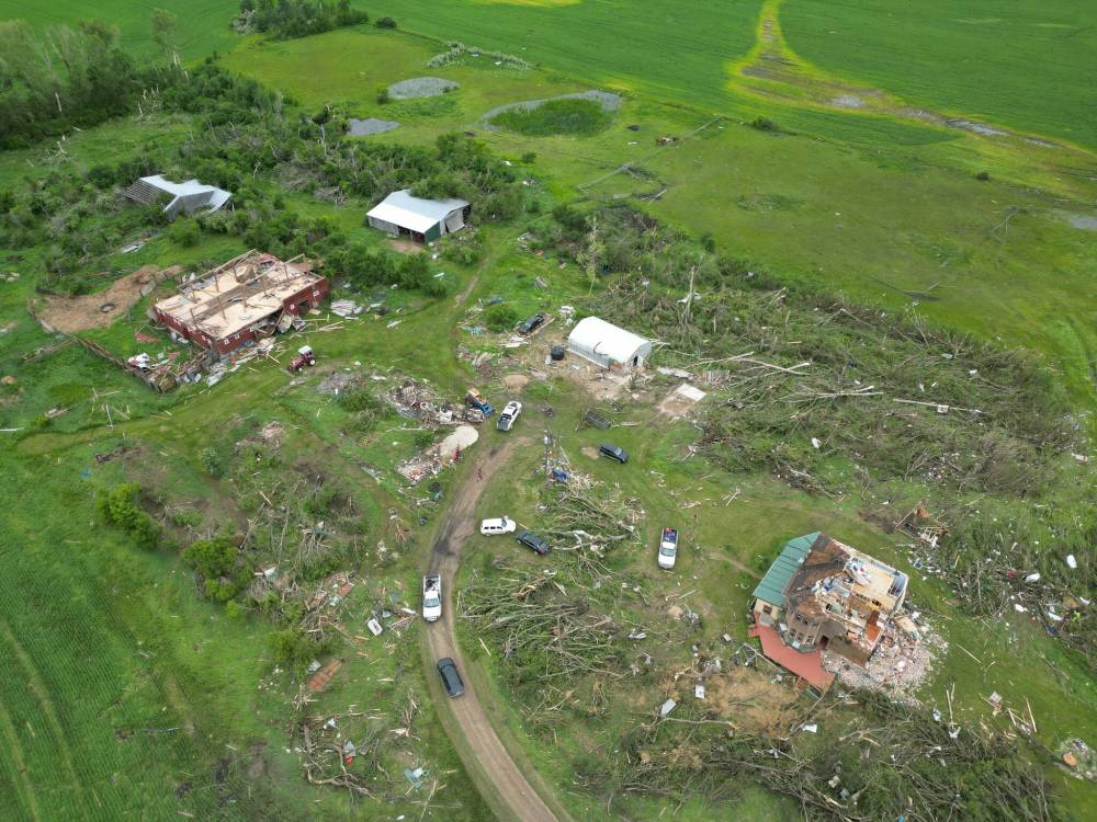
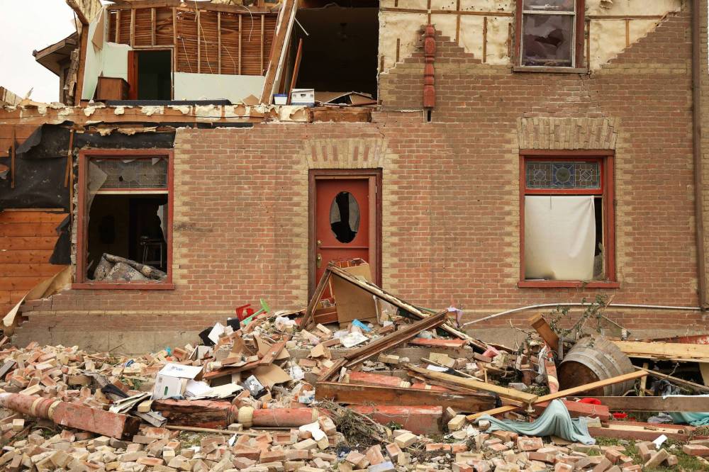
Painchaud-Niemi is trained to associate certain types of damage with wind speeds according to engineering research, and he uses that knowledge on-site to categorize the magnitude of storms. In the case of Rossburn, the worst damage point was at the historic home of Brian and Bernadine Brown, where the roof and some upper walls were torn off by wind.
“From that, we were able to estimate the wind speed at 230 kilometres an hour, which ends up being EF3,” Painchaud-Niemi said. “We were there for a few days. That was also because of the weather. So you can’t fly the drone when it’s raining, and when it’s pouring, it’s also hard to see things.”
The work to assess the damage included a team flown in from London, Ont., where the national lead surveyor at the NTP came in with a fixed-wing surveillance drone and used Light Detection and Ranging (LIDAR), a technique that uses a laser pulse to map the area, to document the damage.
Rossburn is one of a number of sites that have made a busy year for crews, Painchaud-Niemi said. The researcher has visited Kenora, Ont., Rainy River, Ont., Winnipeg, Rossburn, Roblin, Oxbow, Sask., Carlyle, Sask., Saskatoon, Sask., and the Peace Country region of Alberta this year documenting storm damage. There has been a lot of driving and hotel stays, he said.
Researching tornadoes can be tiring at this time of the year and Painchaud-Niemi takes measures to ensure he doesn’t overwork.
“When you’re on the road it’s about making sure you’re getting enough rest … and if you are starting to get burnt out, to tone it back,” he said. “The most important part is trying not to burn yourself out, and to take rest when you need it.”
The summer months are the busy time of the year for tornado research work, meaning that jobs can pop up at any time, he said.
“We’re basically always generally on call … Whenever there is damage that needs to be surveyed or there is strong interest in a case, we will be sent out. This year has been a very busy summer for that, especially for the prairies.”
The NTP team conducted research from July 29, the day after the Rossburn tornado, through to July 1 on location. When reached last week, Painchaud-Niemi was in Saskatchewan surveying other tornado reports.
David Sills, director of the tornadoes project, said that travel on sudden notice is in the nature of tornado research. He said that the team goes into the summer knowing that there may be sudden requests to get out in the field.
“We’ve got protocols set up to make sure that people don’t get burned out,” he said. “But certainly, you know the expectation is that it’s going to be long days, and you know you could be going anywhere, flying anywhere during the summertime, and everybody’s prepared for that.
“Sometimes, what you think might be a one-day trip turns into a five-day trip.”
Sills said it has been a busy year. For the first time since forming in 2017, the project had five crews in the field assessing storm sites at the same time this year, he said.
The on-the-ground crews are crucial to the research. Sills said the crews enable the research project to properly classify storms by observing careful details, such as the fall path of trees, and damage to property. Recording this amount of detail cannot be done from a desk, he said.
“Having the ground teams out there is essential,” he said. “We need to assess the condition of the construction, the damage in the surrounding area, it all has to be pretty much consistent to get that high of a rating (of a storm).”
“Being able to be on the ground, get drone imagery from the ground team and see from above using a drone, get all the details at the ground level, that allows us to really assess the details of the the damage path, and it’s the kind of thing you just can’t get with satellite imagery.”
The NTP uses satellite imagery to make before-and-after photo comparisons of affected areas, identifying “scars” left in the ground from tornadoes. But satellite images do not empower the project to fully classify storms because they do not provide enough information about the nature of the damage, Sills said.
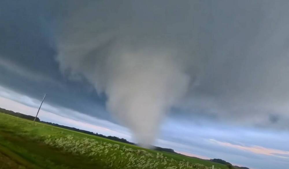
The tornado that ripped through Brian and Bernadine Brown’s home is seen just one minute after touching down in Westman, and minutes before it reached the couple’s home. Aaron Jayjack, a storm chaser, filmed the touchdown from his vehicle while following it across the countryside. (Aaron Jayjack/Extreme Storm Chaser/Facebook)
“It just won’t answer all of the questions that we have, and need to answer, to properly document a tornado.”
In the case of the tornado in Rossburn, the team noted that the home that was destroyed by the tornado consisted of brick veneer, and was not a solid masonry brick house, which would have changed the context of the classification. The team also determined that it was a single tornado that created the long track of damage in the area.
The project confirmed four tornadoes in total in southwest Manitoba that day.
Sill said that the project has grown over the years and hired more interns. He also said there has been increasing demand to fill the roles — with over 270 applications received this year for the 25 internship positions.
The project is staffed year-round, but the tornadoes project bulks up its staff in the summer to meet the coming needs of on-the-ground research, he said.
For local teams, one survey crew is based out of Winnipeg at the University of Manitoba, a couple of teams are based out of Western University in London, Ont., and a team is based out of southern Alberta, he said.
The southwest region of Manitoba and the southeast region of Saskatchewan are known for “big” tornadoes, and the project keeps an eye on the region, he said.
“This is an area where we have a concentration of these upper-end tornadoes that we don’t see in other parts of the country.”
The NTP in June recorded four tornadoes in the Westman region stemming from June 28.
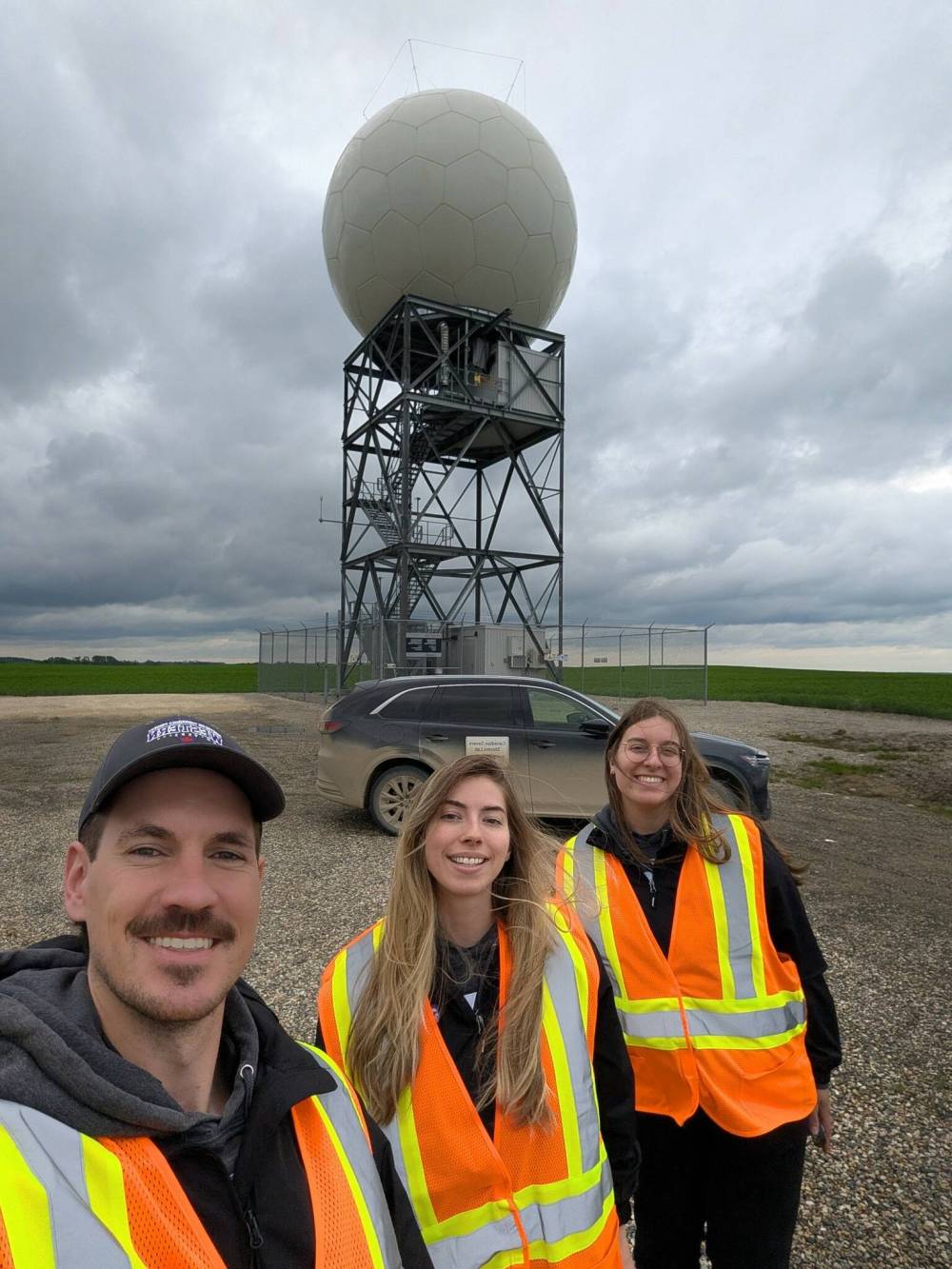
Dylan Painchaud-Niemi (left) with the Manitoba survey team at the Foxwarren radar station. The team travels around Manitoba, and to Saskatchewan and Ontario, documenting damage from storms for the Northern Tornadoes Project. (Supplied)
The first tornado was the EF3 that ripped through the home near Rossburn during a track of nearly 14 kilometres.
The second was classified an EF1 and found to start near Little Menzie Lake and track just over seven kilometres.
The third tornado was ranked an EF2, near Roynick Lake and was found to have a track length of about 6.8 kilometres.
The fourth touched down near Dropmore at Lake of the Prairies and and was classified EF1.
»cmcdowell@brandonsun.com