Sioux Valley evacuees cleared to return home
Advertisement
Read this article for free:
or
Already have an account? Log in here »
We need your support!
Local journalism needs your support!
As we navigate through unprecedented times, our journalists are working harder than ever to bring you the latest local updates to keep you safe and informed.
Now, more than ever, we need your support.
Starting at $15.99 plus taxes every four weeks you can access your Brandon Sun online and full access to all content as it appears on our website.
Subscribe Nowor call circulation directly at (204) 727-0527.
Your pledge helps to ensure we provide the news that matters most to your community!
To continue reading, please subscribe:
Add Brandon Sun access to your Free Press subscription for only an additional
$1 for the first 4 weeks*
- Enjoy unlimited reading on brandonsun.com
- Read the Brandon Sun E-Edition, our digital replica newspaper
*Your next Free Press subscription payment will increase by $1.00 and you will be charged $20.95 plus GST for four weeks. After four weeks, your payment will increase to $24.95 plus GST every four weeks.
Read unlimited articles for free today:
or
Already have an account? Log in here »
Hey there, time traveller!
This article was published 05/04/2017 (3388 days ago), so information in it may no longer be current.
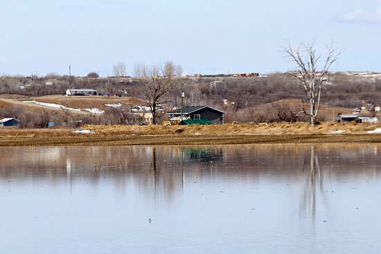
Evacuated residents in Sioux Valley Dakota Nation were given the all-clear to return home on Tuesday.
The Red Cross confirmed the evacuation order, in place for 11 residences in a low-lying area of the community’s northeast, had ceased.
The mandatory order was given Sunday night to 34 people when water from a rising creek washed over a bridge, the region’s only all-season access. By next morning, the water already dropped a few feet, but the evacuation remained as a precaution.
In 2014, residents were evacuated from their homes for a month when the creek overwhelmed its banks. A total of 876 people were forced to leave.
Red Cross facilitated Sioux Valley’s disaster response assistance into Brandon. It was also behind flood evacuations for 146 people in Peguis First Nation, north of Winnipeg, and 35 more people in Long Plain First Nation, beside Portage la Prairie.
Elsewhere in southwestern Manitoba, the effects of a quick spring melt and a heavy snowpack are reverberating through the region.
In the Municipality of Grassland, two families, evacuated on the weekend, may not return home until later this week, said Head of Council Blair Woods.
North of Lauder, a bridge spanning the Souris River and a nearby road became threatened, forcing the evacuation.
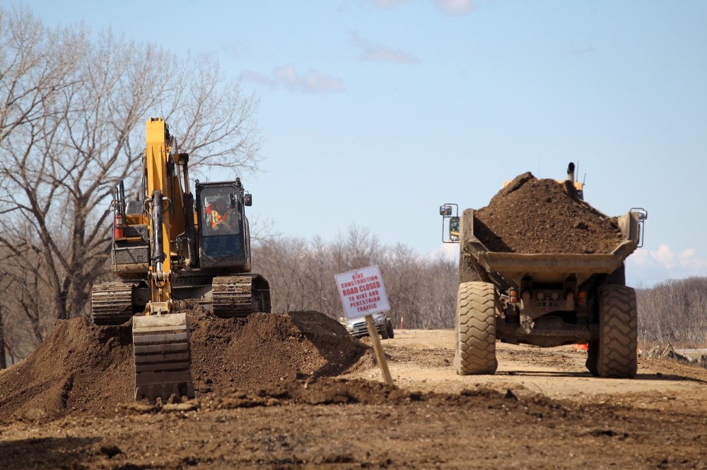
Since then, a total of three bridges have been closed, and Woods estimates between 25 to 30 roads, inundated by water which washed away gravel and punctured the roadway, will require upgrades once floodwaters recede.
“It’s subsiding in places,” Woods said Tuesday of the municipal-wide flood threat, “but even this morning we had two more roads go.”
Given the amount of snowfall this winter, Woods isn’t surprised at the pervasiveness of the water.
“We’re about at the level of the 2011 (flood) for the amount of roads we have damaged.”
In the Municipality of Two Borders, which has been under a local state of emergency since last Thursday, 100 roads are closed, 75 of which require repairs, estimated Head of Council Debbie McMechan.
“We have everything from a relatively minor spillover to areas where we think, ‘Here, we go again,’” McMechan said, alluding to the 2014 flood, which resulted in damages worth millions of dollars.
The water has jeopardized approximately 10 homes at some point in the province’s most southwestern municipality. Some of the residences are now protected by Tiger Dams — a sandbagging alternative, wherein plastic tubes are filled with water.
She suggested the Stony Creek, South Antler Creek and 600 Creek are among the waterways causing the worst damage, but she said Tuesday “you can definitely see the water is receding” municipal-wide.
The worst of the flooding appears to have floated through St. Lazare, the site of a mass effort Monday involving firefighters and the province’s Emergency Measures Organization (EMO) to protect three residences.
Municipal Head of Council Barry Lowes was told Tuesday morning the Qu’Appelle River dropped a few more inches overnight.
“I’m quite optimistic that we’ve probably seen the high point,” he said.
Downstream in Brandon, the city decided Tuesday to close Dinsdale Park and Queen Elizabeth Park, recreational areas neighbouring the Assiniboine River, as a response to rising water. Access to the pedestrian walking bridge at Riverbank Discovery Centre is now denied as well.
The Assiniboine River has reached a height at First Street of 1,173.93 feet above sea level. The city is expecting the river to peak three feet above its present height sometime next week.
The dike’s elevation is 1,186 feet above sea level.
The city is readying for the crest by sealing manholes, readying pumps and preparing to close outfalls, a press release indicated.
West of Brandon, Jean Mills, a retiree living in Kemnay, is frustrated to again walk into a flooded basement.
A representative from the Municipality of Whitehead visited her home yesterday to take pictures of the damage. Though flooding isn’t overland in her place, she said water is again seeping into her basement, where Mills is using pumps and blankets to stop the leakage.
“It would fill the whole basement if I let it,” she said.
Mills refurnished her basement in 2014 after it filled with three to four feet of water. She received only $400 in disaster relief from the province, she said.
In Tuesday’s flood update, the province expressed that southern Manitoba remains vulnerable to overflowing waterways and overland flooding, much of which is due to melting ice blocking the flow of rivers.
Some snowpack remains in the western part of the Souris River basin, Riding Mountain area, Parkland region and Duck Mountain area, which is a warning for increased runoff. A lot of snow has already melted in the province’s southern reaches.
A high water advisory was issued for the Little Souris River, which empties into the Assiniboine south of Brandon, due to a significant rise in water levels.
A flood watch has been issued for Pelican Lake and a flood warning is now in effect for the Pembina River on La Riviere due to overbank flows.
On Monday, the provincial government had eight states of local emergency on the books, including Two Borders, Grassland, Brenda-Waskada, Prairie Lakes, Dufferin, Grey, La Broquerie and the Town of Carman.
» ifroese@brandonsun.com
» Twitter: @ianfroese